
Avalanche Bulletin
更新日時: 2024/03/14 07:00
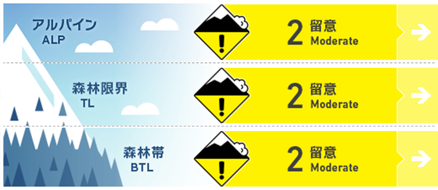
Niseko Yotei Yoichi Shiribeshi
Alpine Low Limited observations reduce our confidence
Treeline Low Limited observations reduce our confidence
Below Treeline Low Limited observations reduce our confidence
信頼度:○ good □ Fair △ Low
Travel and Terrain Advice
The spring diurnal cycle brings reduced hazard in the morning when temperatures are cool but the hazard can increase rapidly as the temperatures rise. Monitor the changing conditions carefully and adjust your travel plans accordingly. Avoid travel on or near cornices as they are becoming weak and fragile with these warming trends. The next bulletin will be issued Saturday morning.
Avalanche Problem
ウインドスラブ Wind slab


Pockets of windslab remain on leeward slopes and will become more reactive with day time heating.
全層雪崩 Glide slab


Springtime weather ensures that the glide avalanche problem remains present at all times particularly on solar aspects and steep slopes.
概要
Avalanche
No new avalanches have been reported however we have limited observations in recent days.
Snowpack
The spring diurnal cycle has helped the storm snow to settle and bond however rising day time temps continues to activate avalanche problems later in the day, particularly at lower elevations and on solar aspects when the sun comes through. 20-50cm of storm snow overlies the Feb. 20th rain crust. Multiple solar and temperature crusts exist within the settled storm snow on solar aspects and at lower elevations.
Weather
A ridge of high pressure sits over Hokkaido bringing light WNW winds today (Thursday). After a good overnight freeze, temps will rise to 5 degrees in the valley today accompanied by mostly overcast skies. Temps will drop again overnight tonight before climbing above freezing again tomorrow. A new system arrives tomorrow afternoon with moderate to heavy snowfall expected to begin early Friday afternoon.


