
Avalanche Bulletin
更新日時: 2024/01/28 06:00
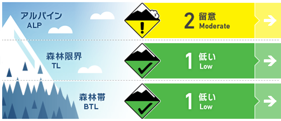
Myoko
Alpine Low Note the start of snowfall
Treeline Fair Note the start of snowfall
Below Treeline Fair Watch for the onset of rainfall
信頼度:○ good □ Fair △ Low
Travel and Terrain Advice
Watch for unstable snow remaining in terrain pockets at higher elevations. Watch for slabs that have formed in areas where the snowpack is likely to be unstable, such as isolated terrain of extreme shape. Also, remember to check for terrain traps below them. The snowpack at lower elevations is thin and the gully is not fully filled. Be alert for other hazards besides avalanches. Wise terrain use and the habituation of a principled course of action will reduce the number of accidents. Radiative cooling is cooling the snow well. Have a good day.
Avalanche Problem
概要
Avalanche
Several size 1 loose snow avalanches or slab avalanches were reported yesterday (27th). All were caused by snowfall during the day yesterday.
Snowpack
The previous stormy snow has been settling and is in the process of stabilizing. During the day yesterday, there was a weak snowfall mainly in the northern part of the mountain area, which indicated instability. No problems have been detected so far at the boundary of the Melt-Freeze layer, which is buried in the middle layer of snow.
Weather
Today, the area is expected to be affected by a pressure trough and cold air. The Japan Meteorological Agency is forecasting winds from the south, later from the west, snow or rain, morning and evening showers, cloudy skies, and daytime highs of 4 °C (13 m elevation) for the Joetsu region of Niigata Prefecture. At Sasagamine, Myoko (elevation 1,310 m), the temperature is -6 °C (as of 4:45 a.m.), with no new snowfall in the past 12 hours.