Avalanche Bulletin
更新日時: 2024/01/23 05:30
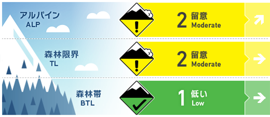
Hakuba
Alpine Fair Beware of instability in terrain pockets.
Treeline Good Note slabs formed by strong winds with the onset of snowfall.
Below Treeline Good
信頼度:○ good □ Fair △ Low
Travel and Terrain Advice
Although the overall avalanche danger level is low at this time, the weather conditions continue to worsen as fierce winds have already begun to blow on the main ridge. Be on the lookout for slabs that will form as the snowfall begins. Also, be very careful of slides on hard snow and holes in stream bottoms, in addition to avalanches. For less experienced groups, this is a good day to enjoy the nicely pressurized runs in the ski area.
Avalanche Problem
ウインドスラブ Wind slab


概要
Avalanche
Yesterday morning (22nd), a size 2 glide avalanche was observed at the ski resort. This was due to the effects of high temperatures and rainfall over the past few days. On the other hand, no new avalanches were observed in the mountain areas.
Snowpack
At lower elevations than around 2,100 m, Melt-Freeze crusts 1-3 cm thick are forming on the snow surface. At elevations higher than around 2,100 m, low-density snow is hiding under wind slabs, a situation that is responsive to human stimuli, as was observed yesterday.
Weather
Today, a winter pressure pattern is expected to gradually develop, and the area will be affected by a pressure trough and cold air. The Japan Meteorological Agency is forecasting northerly winds, cloudy skies, snow at night, and daytime highs of 4 °C for northern Nagano Prefecture. At Amedas Hakuba (elevation 703 m), the temperature is -0.4 °C (as of 5:00), with no snowfall in the past 12 hours.