
Avalanche Bulletin
更新日時: 2023/11/19 06:00
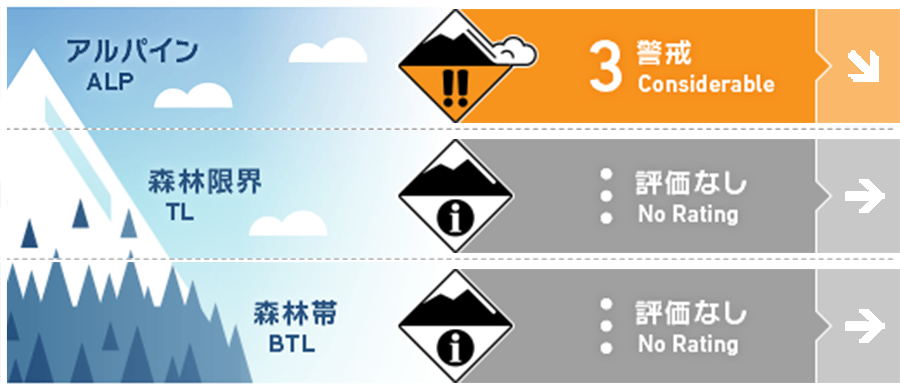
Tateyama
Alpine Low Watch out wind slab.
Treeline
Below Treeline
信頼度:○ good □ Fair △ Low
Travel and Terrain Advice
Wind slabs are currently expected to form downwind due to snow movement caused by strong winds. Since the newly formed windslab has not yet bonded, please be careful of triggering on steep slopes directly below the ridge or branch ridges.. Many "terrain traps" such as rocks and gullies are exposed where even small avalanches can cause extensive damage. Be careful of crashing into rocks that are thinly concealed by the snowfall. Poor visibility makes it difficult to recognize avalanche terrain overhead. Please be aware of changes in snow cover conditions due to wind and snowfall in the future.
Avalanche Problem
ウインドスラブ Wind slab


Be careful of steep slopes directly below the ridge or branch ridges.
概要
Avalanche
Yesterday (18th), poor visibility prevented important observations.
Snowpack
Snow depth near 2400m is about 70cm, and under the influence of strong westerly winds, snow is blown away at windward locations, forming wind slabs on steep downwind slopes. A layer of faceting that has begun in the middle part of the snowpack has been observed, and attention should be paid to the future decrease in bonding.
Weather
The temperature at 3000m as of 6:00 am was -10.4℃, with strong winds and poor visibility around 2400m. The Japan Meteorological Agency (JMA) is forecasting rain at the foot of the mountain and cloudy skies from early afternoon due to the influence of cold air and a low-pressure system with a front moving eastward over the Sea of Japan.