
Avalanche Bulletin
更新日時: 2023/02/18 07:00
Niseko Yotei Yoichi Shiribeshi
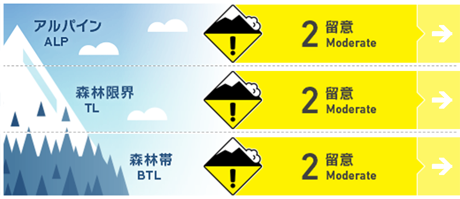
Alpine Fair Windslabs may still be present on slopes lee to the wind and on slopes that have been cross loaded from the winds. Watch for solar input on alpine slopes.
Treeline Fair Look for signs of windslab on lee slopes and wind pressed snow in exposed areas and at ridge crest and below. Watch for solar input on slopes at tree line if the sun comes out and temperatures warm.
Below Treeline Good Watch for warming temps and if the snow is becoming heavy and dense at lower elevations.
信頼度:○ good □ Fair △ Low
Travel and Terrain Advice
Weather: mother natures architect.... has created varying conditions and hazards through the region depending on aspect and elevation. Glide cracks continue to be a hazard and though very impressive, can be difficult to see from above or when covered by fresh snow. Travel through all terrain with open eyes and share with your riding partner about what you see.
Avalanche Problem
ウインドスラブ Wind slab


strong winds and new snow in past 48 hrs may have created slab on slopes north east through south east.
点発生湿雪雪崩 Wet Loose snow


Sun and warm temps could heat the snow making it dense and heavy. A degree of uncertainly lies in how warm and how much solar input the slopes will have. The more solar input, the higher the hazard.
概要
Avalanche
Avalanche activity has been reported in the last 48 hrs on all elevation bands, ranging from windslab on lee slopes at tree line and above and loose dry on steep sheltered slopes. If temps warm with the sun, watch for loose wet snow.
Snowpack
New snow has fallen in the region in the last 48hrs adding to the snowpack with the northern region receiving the most snow. Underneath the new snow, the upper and middle snowpack seem to be of similar density, however loose sugar snow has been found 50-60cms below on North aspects.
Weather
It looks like the snowfall will taper as the weekend begins and will continue again Sunday evening. Sun is forecasted through the weekend with temps around freezing and becoming above freezing during the daytime in some regions. Winds light and will start from the west, swirl around and end up from the north by Sunday evening. Keep watch for warm days followed by cool nights and what that does to the snow surface.


