
雪崩情報
更新日時: 2022/03/24 07:00
ニセコ・羊蹄・余市・尻別
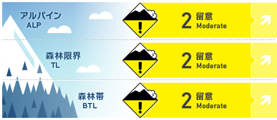
アルパイン Good
森林限界 Good
森林帯 Good
信頼度:○ good □ Fair △ Low
行動と地形の助言
積雪が融解凍結のサイクルにあるため、雪面は朝の硬い状態から、日中には濡れて重たくなるまで多様な変化があります。春シーズンを通して気をつけてほしいことは、グライドクラックが入った斜面の下方で留まらないことです。As we are in a melt-freeze cycle the snow surface will change from firm conditions in the morning to wet and heavy in the heat of the day. Throughout spring be mindful of your location in relation to glide cracks and avoid time below.
留意すべき雪崩
点発生湿雪雪崩 Wet Loose snow


F金曜日には凍結硬度がアルパインまで上昇する予報が出ていますので、方位を問わず、濡れた雪の点発生雪崩の可能性が高まります。この種類の雪崩は、時間のタイミングが鍵です。雪面の状態は短時間で、急激に変化する場合があることを覚えておいてください。急斜面や岩が露出している斜面などで、スノーボールを発見したら、それは雪面の雪が弱くなっている兆候ですので、注意してください。Freezing levels will rise into the alpine by Friday creating the possibility of wet loose activity on all aspects. Timing is critical when managing wet loose conditions and the snow surface conditions can change rapidly in a short period of time. Look for signs of roller balling in steep terrain or from rock features as an indicator that the snowpack is becoming weak.
概要
雪崩
昨日(23日)、イワオヌプリで点発生湿雪雪崩があった旨の報告を受けました。詳細ははっきりしていませんが、方位は北東で、自然発生の可能性があるとされています。We received some vague reports of a large wet loose avalanche on Iwaonupuri on the 23rd of March. This slide is reported to have possibly been triggered naturally on a NE aspect.
積雪
週明けに短時間で15 cmの降雪があり、一時的に冬に戻りましたが、これからは、再び、春らしいコンディションが期待できそうです。積雪は、融解凍結のサイクルにあり、アルパインまで凍結硬度が上がれば、湿った雪となり重たい状況になります。今後予報されている降雨は、積雪の中層から下層に対して、破壊的な影響を与えることになると思います。With a brief return to winter early in the week as we received over 15cm of new snow in a short period of time, it looks like we can expect more spring-like conditions in the coming days. The snowpack is now in a melt-freeze cycle and as the freezing levels rise into the alpine the snow surface will become wet and heavy during the day. Any upcoming rain-on events will be destructive to the mid and lower pack.
天候
北海道は高気圧に覆われますが、やや雲が広がりやすく、強い日差しがありでしょうが、風は弱いとのことです。南風が入ることで昇温し、週末には凍結硬度は標高1,000 mを超える予報が出ています。Hokkaido sits under a high-pressure system resulting in broken clouds with sunshine and light winds. A southerly flow will bring warm air to the region raising the freezing level to above 1000m at the end of the week.


