
Avalanche Bulletin
更新日時: 2024/03/31 04:00
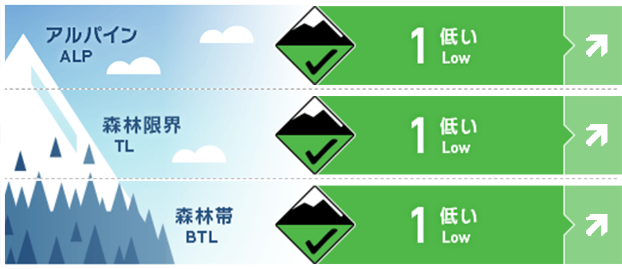
Kagura Tanigawa Hotaka
Alpine Low Note the increase in daytime hazards.
Treeline Fair Note the increase in daytime hazards.
Below Treeline Good Note the increase in daytime hazards.
信頼度:○ good □ Fair △ Low
Travel and Terrain Advice
The spring cycle has begun. Avalanche danger levels vary widely from "low" to "high" during the course of a day, depending on daytime temperatures and the effects of solar radiation. We recommend that you take action before the crust loosens up due to the effects of solar radiation and warmer temperatures. Watch for loose snow avalanches from large steep slopes during the day and glide avalanches from glide cracked areas and cliff-like slopes. Do not enter the lower part of such areas or pass through them quickly. Please also be aware of slab avalanches when snowfall occurs at higher elevations during spring storms. This is the last avalanche bulletin for this area for today. Thanks to everyone who provided information.
Avalanche Problem
概要
Avalanche
No reports of new avalanches observed yesterday (30th).
Snowpack
The snowpack is expected to be wet and then frozen, at least at elevations below 1,700 meters, due to the recent rainfall. At higher elevations where it is turning to snow, bonding is good, although strong westerly winds have formed wind slabs on the downwind stream bottom. There are no reports of significant vulnerability observed in the middle to lower layers of snow cover.
Weather
As of 4:00, the temperature at AMeDAS Fujiwara is 1.8℃. The Japan Meteorological Agency forecasts that the weather will be moderately high-pressure but subject to the influence of a pressure trough and moist air, so it will be sunny and sometimes cloudy, with temperatures rising to 17°C at the foot of the mountains, and yellow dust may be observed.