
Avalanche Bulletin
更新日時: 2022/01/18 07:00
Niseko Yotei Yoichi Shiribeshi
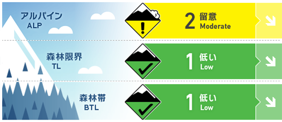
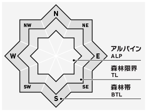
Alpine Good 稜線の東側には地形局所に形成したウインドスラブが残っている可能性があります。Isolated winds slab pockets may remain on Easterly aspects near ridgeline.
Treeline Good 局所に小さいウインドスラブがあるかもしれません。誘発感度は鈍いでしょう。とても急な開放斜面では点発生雪崩の可能性があります。Low volume pockets of slab may remain but will be hard to trigger. Loose dry activity on steep open terrain is a possibility.
Below Treeline Good 地形移動の際、一般的な行動原則を使ってください。Regular safe terrain travel techniques should be used.
信頼度:○ good □ Fair △ Low
Travel and Terrain Advice
There are almost no reports of instability, so there seems to be no doubt that the snow cover is gaining strength. Continue with the general safe terrain movement behavior, and be aware of the windslabs formed in the terrain. If you are approaching Alpine, try to be more aware of the situation on site, and always make it a top priority to safely descend. Confidence has grown in the strength of the snowpack with little in the way of Instabilities being reported. Regular safe travel techniques should continue to be adopted and be mindful of the Possibility of isolated pockets of wind slab found in protected steep angled terrain. As we move into the alpine and more exposed terrain, remember to take time to evaluate conditions in real-time and always have the goal of getting back to the trail head safely as your main priority.
Avalanche Problem
点発生乾雪雪崩 Dry Loose snow


とても急な斜面であれば、少なくとも乾いた結合力の弱い雪が20 cmあれば発生しうると考えてください。このような雪崩は、足元をすくいます。地形の罠が下方にあるような場所の移動は、十分に注意してください。In steep angled terrain loose dry avalanches may be a possibility within the latest 20 cm of new snow. The main concern for these avalanches would be the consequence if you get knocked off your feet. Take extra time if traversing steep terrain above an obvious terrain trap.
ウインドスラブ Wind slab


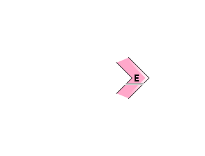
稜線付近の急斜面の局所に、ウインドスラブが形成しています。東側に形成しているウインドスラブは、人間一人の刺激で反応するかも知れませんので、滑らかな雪面でスラブの形成が疑われるところを探してください。Isolated pockets of wind slab may be found on steep angled terrain near the ridgeline. Look for pockets of smooth wind-pressed snow across the Eastly aspects that may be reactive to single-person loads but are likely to be lower volume.
概要
Avalanche
There have been reports that point avalanches with very fast downflow velocities have occurred within the past 24 hours on very steep slopes. There doesn't seem to be a lot of snow that has flowed. We received reports of fast-moving loose dry avalanches in step terrain over the previous 24 hours. These appear to be low volume.
Snowpack
Last weekend's cycle of stormy weather ended, and this week the temperature rose, the snowfall also subsided, and the mild weather continued. During this time, the snow cover will gain strength, and there will be almost no unstable elements except in the middle and lower tiers. Since the end of the previous storm cycle late last week we have had a period of more settled weather with warmer temps and snow flurries during the early part of this week. The snowpack has gained strength during this period and little in the way of instability can be found in the mid to lower pack.
Weather
After this, it is forecast that the north wind will weaken for several hours and weak snowfall will occur. It seems that we can't expect too much snow. Snow flurries are set to continue during the next few days with light to moderate Northerly winds. We are not expecting much in the way of snow accumulation as we remain in a settled Weather pattern.