
雪崩情報
更新日時: 2021/03/06 07:01
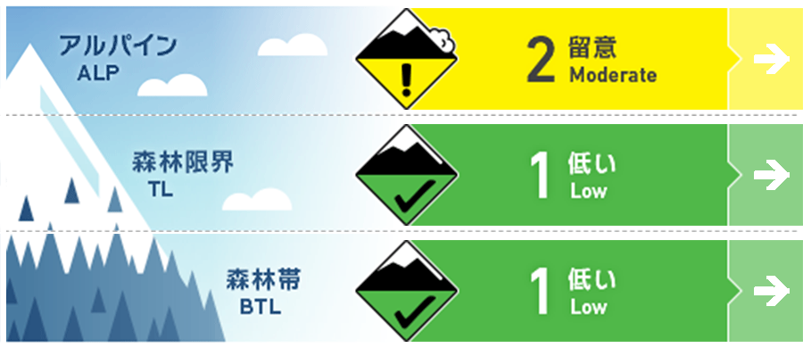
ニセコ・羊蹄・余市・尻別
アルパイン Good Pockets of windslab have formed on East and North East aspects 東~北東の斜面に局所的なウインドスラブが形成
森林限界 Good A dusting of new snow sits on a hard snow surface. 硬い雪面上にある薄い新雪に留意
森林帯 Good A dusting of new snow sits on a hard snow surface. A dusting of new snow sits on a hard snow surface. 硬い雪面上にある薄い新雪に留意
信頼度:○ good □ Fair △ Low
行動と地形の助言
Expect very hard surface snow conditions resulting from the solar and rain crusts. This will make for challenging skiing at low elevations and sliding hazards on steep South facing slopes. 日射と降雨の影響で、とても硬い融解凍結クラストとなっています。標高の低いところでの滑走は技量が必要で、滑落にも十分注意する必要があります。
留意すべき雪崩
ウインドスラブ Wind slab


Look for evidence of wind slab just below ridge crest and convex rolls. 稜線直下や凸状地形に形成しているであろうウインドスラブの証拠を探すように
概要
雪崩
A widespread natural avalanche cycle occurred during and shortly after the severe wind and snow storm on Tuesday and Wednesday. Conditions have stabilized since and no avalanche activity reported in the last 48 hours. 火曜日から水曜日にかけての荒天の直後に、広い範囲において自然発生雪崩が発生しうる雪崩サイクルがありました。その後、コンディションは安定化の方向にあり、過去48時間の間、雪崩活動の報告はありません。
積雪
The storm scoured most aspects in the alpine although good snow remained on North slopes at and below treeline which is now bonding well to the lower pack. 北斜面には良い雪が残っていたのですが、アルパインでは暴風によって吹き飛んでしまいました。森林限界より標高が低いところでは、積雪は沈降し、焼結を進めています。 A thick melt freeze crust now exists on solar aspects as a result yesterday`s warm weather. Rain at low elevations was added to the surface of all aspects on Friday night.
天候
Light snow will taper off Saturday morning before giving way to overcast skies with the occasional sunny break through to the end of the weekend while temperatures remain below freezing across the region. Expect moderate to strong NW winds today before decreasing in intensity tomorrow. 本日(土曜)は小雪から曇りとなり、氷点下のまま、ときどき晴れる予報がでています。中から強めの北風が吹く予報が出ていますが、明日には弱まるとのことです。


